Sugou Riverbank Ishigaki Stone Walls (Location: eastern sections)
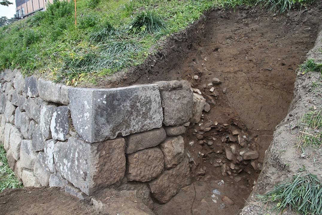
This eastern section of ishigaki stone wall was built facing the Sugou River (currently the Oto River). Because the Sugou River flooded causing damage, the Kagosaki Tsutsumi, an artificial embankment was built the middle of the river to stabilize the flow path in conjunction with the stone wall. Construction of both were carried out simultaneously in either 1624 or 1644. About 400 m of stone wall from here to the western end downstream can still be seen, but the Kagosaki embankment was buried under modern river maintenance works and can no longer be seen.
Excavations conducted in 2016 revealed the dry-stone walls had been built on foundations of thick wooden logs laid horizontally to ensure settling remained stable along the length of the wall, which was around 5.4m in height.
Okazaki Castle Outer Moat Enclosure >


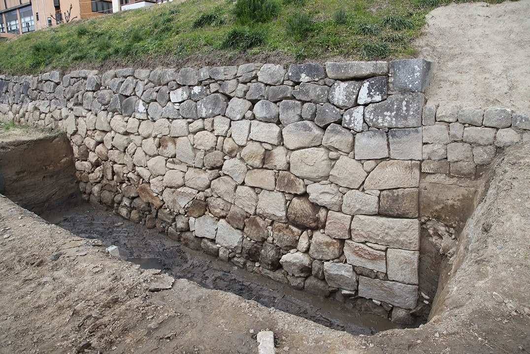
Sugou Riverbank Ishigaki Stone Walls (Location: eastern sections)
This eastern section of ishigaki stone wall was built facing the Sugou River (currently the Oto River). Because the Sugou River flooded causing damage, the Kagosaki Tsutsumi, an artificial embankment was built the middle of the river to stabilize the flow path in conjunction with the stone wall. Construction of both were carried out simultaneously in either 1624 or 1644. About 400 m of stone wall from here to the western end downstream can still be seen, but the Kagosaki embankment was buried under modern river maintenance works and can no longer be seen.
Excavations conducted in 2016 revealed the dry-stone walls had been built on foundations of thick wooden logs laid horizontally to ensure settling remained stable along the length of the wall, which was around 5.4m in height.