A TSUNAMI IS SURE TO STRIKE AGAIN
More than 1,000 years ago A tsunami of the same scale as the Great East Japan Earthquake
869 The 869 Jogan Earthquake and Tsunami
A tsunami of similar scale to the Great East Japan Earthquake struck northern Japan during the ninth century. Tsunami sediment research, which involves excavations to find layers of sand deposits from past tsunamis, revealed that the tsunami had swept three kilometers inland on the Sendai Plains. It appears that the areas flooded then closely correspond to those of the 2011 Great East Japan Earthquake. This is the oldest documented occurrence of a tsunami in the Tohoku region.
●Damage from this tsunami of over 1,000 years ago described in Nihon Sandai Jitsuroku (The True History of Three Reigns of Japan)
The Nihon Sandai Jitsuroku describes a huge tsunami that reached as far as the Tagajo area, where the provincial government was located.
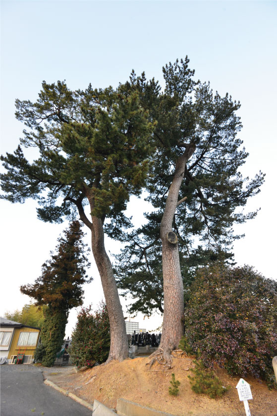
●The legend of Sue-no-Matsuyama in Yawata, Tagajo City
It is said that when all Tagajo was flooded, the waters failed to cover the hill of Sue-no-Matsuyama. Because of this, Tagajo became an utamakura, a famous spot often cited in waka poetry. The waters again failed to cover the hill in the 2011 Great East Japan Earthquake.
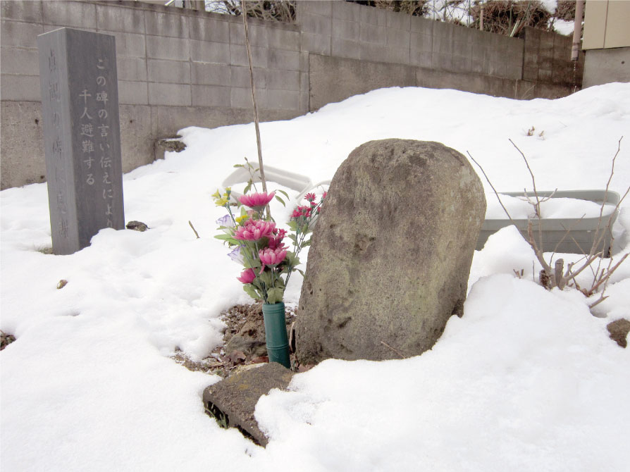
●869 Jogan Earthquake and Tsunami Monument in central Miyato Island, Higashi-Matsushima City.
Legend has it that a large tsunami rushed in from both sides and crashed into itself in the central part of the island.
・ Date and time: Night of July 13, 869
・ Scale of earthquake: Magnitude 8.3 or higher
・ Epicenter: Offshore Sanriku (N 37.5–39.5, E 143.8)
・ Tsunami height: Reportedly at least 10 meters
・ Dead: 1,000 drowned in the vicinity of Tagajo City, Miyagi Prefecture (according to historical sources)
The disaster that made the word “tsunami” known all over Japan
1611 The 1611 Sanriku Earthquake and Tsunami
A massive tsunami struck the coast between Tohoku and eastern Hokkaido in 1611 during the early Edo period when Masamune Date ruled the region. According to historical documents, casualties in the Sendai Domain alone numbered 1,783, with major damage recorded in various places along the coast. The word “tsunami” was used in an official document to describe the kind of wave that struck. The word came to be known all over Japan because of this event.
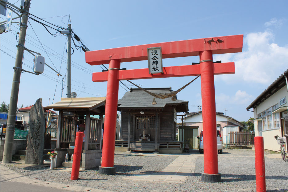
●The origin of the name of Namiwake Shrine (Kasuminome area of Wakabayashi Ward, Sendai City)
Namiwake Shrine takes its name from a tsunami wave that reached this spot, then split into two before receding.
●A tsunami is noted in the shogun’s official diary Sumpuki
Masamune Date, lord of the Sendai Domain, reported the tsunami to the shogun, Ieyasu Tokugawa.
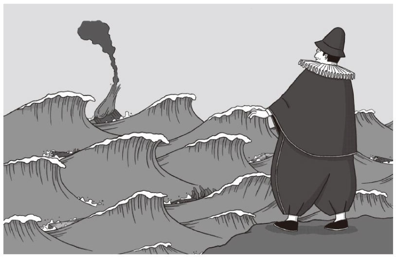
●The Vizcaíno Report, the first instance of a Japanese tsunami being reported internationally
Explorer Sebastián Vizcaíno, who was in Japan as a special envoy from Spain, encountered the aftermath of the tsunami while surveying the coast of the Sendai Domain. He described the state of the damage in a report.
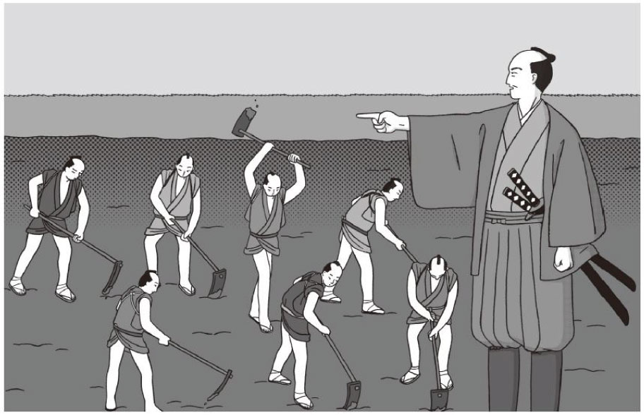
●Earthquake reconstruction by the lord of the Sendai Domain, Masamune Date
Masamune was witness to the damage caused by the tsunami and ordered the undertaking of reconstruction work. He had Magobe Kawamura construct a canal (which later became the Teizan Canal) linking the mouths of the Abukuma and Natori Rivers.
・ Date and time: Approximately 11 AM, December 2, 1611
・ Scale of earthquake: Magnitude 8.1 or higher
・ Epicenter: Offshore Sanriku (N 39.0, E 144.4)
・ Tsunami height: Estimated height of 20 meters in Taro, Iwate Prefecture
・ Dead: 1,783 in Sendai Domain
Even a relatively weak earthquake can cause a tsunami
1896 The 1896 Sanriku Earthquake and Tsunami
On the night of May 5 in the lunar calendar, people were celebrating Tango no Sekku together with the one-year anniversary of Japan’s victory in the First Sino-Japanese War. During their celebrations, some may have felt the weak tremors of an earthquake, although many did not notice at anything at all. About 30 minutes later, a massive tsunami struck the coast, accompanied by a deafening sound. Coastal settlements were destroyed, with victims amounting to some 20,000 people, which was the largest number of deaths ever caused by a tsunami on record at that time. There were approximately 3,000 victims in Miyagi Prefecture alone.
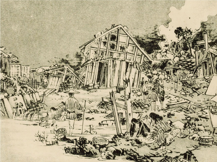
●The tragedy as was depicted in the graphic magazine Fuzoku Gaho.
In the village of Utatsu (part of present-day Minamisanriku Town, Miyagi Prefecture), the tsunami struck in the middle of a wedding ceremony.

Shizugawa (part of present-day Minamisanriku Town, Miyagi Prefecture) after the tsunami. One can see the terrible state of the town and its grieving people.
●Collective relocations to elevated areas begin
Collective relocations to safe, higher ground started to take place in settlements along the coast. However, some communities that had been fishing villages found it more convenient to return to low-lying areas, and several places were once again destroyed in subsequent tsunamis.
・ Date and time: 7:32 PM, June 15, 1896
・ Scale of earthquake: Magnitude 8.2
・ Epicenter: Offshore Sanriku (N 39.5, E 144.0)
・ Tsunami height: Maximum of 24.4 meters (figure varies according to the source) in Sanrikuchoyoshihama (part of present-day Ofunato City)
・ Dead: Approximately 22,000 (3,000 in Miyagi Prefecture) (includes missing persons)
A major earthquake 37 years after the Meiji-period quake of 1896
1933 The 1933 Sanriku Earthquake and Tsunami
At midnight on March 3, the day that Hinamatsuri is celebrated, a violent earthquake with an intensity level of 5 on the Japanese seismic scale struck the Sanriku region. The tide began to ebb soon after, and it is said that the sand and pebbles on the steeply sloping beach made a loud rumbling sound. A major tsunami struck the coast 30 to 60 minutes after the quake. Many evacuated, but others were influenced by their experience of the tsunami 37 years prior, mistakenly believing that earthquakes which precede tsunamis are weak. These people were slow to evacuate, and lost their lives.
●The initiation of full-scale measures such as relocation to higher ground, the construction of seawalls, and the planting of tsunami-control forests
Construction of memorial stones and memorial halls to convey lessons learned In the prefecture, 15 villages and towns and 60 settlements were relocated to elevated areas, and the ground level was raised. Tsunami memorial stones were erected in each affected settlement and memorial halls were constructed in 32 different locations.
●Tsunamis and the Villages by Yachiro Yamaguchi, who researched tsunamis along the Sanriku Coast
Yachiro Yamaguchi visited many parts of Tohoku on foot, but particularly the Sanriku area, researching the process of reconstruction and how people lived in tsunami-affected areas.
Date and time: 2:31 AM, March 3, 1933
Scale of earthquake: Magnitude 8.1
Epicenter: Offshore Sanriku (S 39.14, E 144.31)
Tsunami height: Maximum of 23 meters in Sanrikuchoryori, Iwate Prefecture (part of present-day Ofunato City)
Dead: Approximately 3,000 (including missing persons)
A tsunami from the other side of the earth
1960 The Great Chilean Earthquake and Tsunami
In 1960, a tsunami struck the Pacific coast of Japan suddenly, without any pre-warning tremors. It was caused by a major earthquake that occurred the previous day in Chile, on the other side of the Pacific Ocean in South America. The earthquake was the most powerful ever recorded in the world. A huge tsunami crossed the Pacific Ocean at a tremendous speed, averaging 750 kilometers per hour. It reached Japan, some 17,000 kilometers away, 22.5 hours later and caused great damage to the Sanriku Coast in particular. On this occasion, the official tsunami warning in Japan was issued after the arrival of the wave. Since then, an international cooperation system has been established to ensure adequate tsunami preparation.
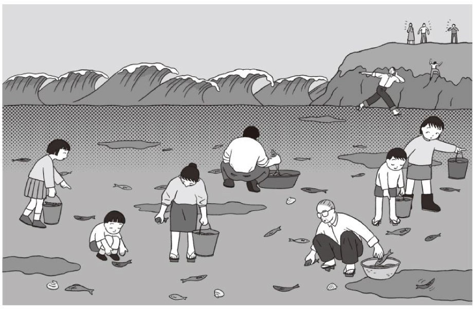
●Going to collect fish . . .
Not only did they not evacuate, but there were some people who went to collect fish that were jumping around, exposed on the seabed after the drawback. They lost their lives when the tsunami struck.
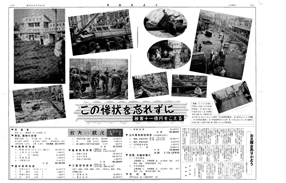
●“A Tragedy Not to Be Forgotten”
Shiogama City Newsletter, published a month after the Great Chilean Earthquake and Tsunami (June 24, 1960)
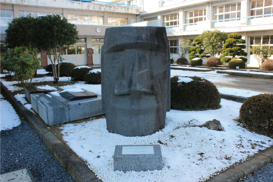
●A moai statue, a symbol of recovery, friendship, and disaster prevention
The Shizugawa area of Minamisanriku Town (formerly Shizugawa Town) suffered severely, including 41 casualties. The town strengthened its relationship with Chile through the process of reconstruction.
In 1991, the town was presented with a moai statue.
・ Date and time: 3:11 PM (local time), May 22, 1960; 4:11 AM (Japan time), May 23, 1960
・ Date and time of arrival of tsunami in Japan: 2:20 AM (Japan time), May 24, 1960
・ Scale of earthquake: Magnitude 9.5
・ Epicenter: Offshore southern Chile (S 41.0, W 73.5)
・ Tsunami height: 5.5 meters in Ofunato City, Iwate Prefecture
・ Dead (Japan): 142 (54 in Miyagi Prefecture) (figures include missing persons)
The first post-WWII earthquake in an urban area
1978 The 1978 Miyagi Earthquake
In the 1978 Miyagi Earthquake, most deaths due to the collapse of concrete block walls or damage caused by broken or collapsed roofs occurred in the city of Sendai. The earthquake is considered to have been the first disaster of its kind since World War II to have occurred in a city with a population of over 500,000. Japan’s Building Standards Act was revised in 1981 to its current earthquake resistance standards based on lessons learned from the disaster. These resistance standards were proven to be highly effective in the Great Hanshin Earthquake of 1995. Additionally, Japan’s Earthquake Insurance System underwent significant revisions in 1980, regarding matters such as increased payout amounts and the newly introduced half-loss categories for buildings.
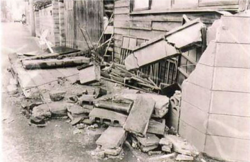
・ Date and time: Approximately 5:14 PM, June 12, 1978
・ Scale of earthquake: Magnitude 7.4
・ Epicenter: Offshore southern Kinkasan Island, Miyagi Prefecture
・ Tsunami height: 14–22 centimeters on the Pacific coast of the Tohoku region
・ Dead (Miyagi Prefecture): 27
60% of people fail to evacuate despite a major tsunami warning
2010 The Chile Earthquake and Tsunami
The 2010 Chile Earthquake and Tsunami caused enormous damage locally. A tsunami about one meter in height also struck along the Pacific coast of Japan, causing damage to the aquaculture industry along the Sanriku Coast. The Japan Meteorological Agency issued warnings before the arrival of the wave.
A subsequent questionnaire revealed that while the majority of the population (98.4%) saw and heard the warnings, less than 40% actually evacuated. When they saw that the first wave was small, over 30% of people returned home from evacuation sites without waiting for the warning to be lifted.
・ Date and time: 3:34 AM (local time), February 27, 2010; approximately 3:34 PM (Japan standard time), February 27, 2010
・ Date and time of arrival of tsunami in Japan: Approximately 2:11 PM (Japan standard time) onward, February 28, 2010
・ Scale of earthquake: Magnitude 8.8
・ Epicenter: Offshore central Chile (S 35.846, W 72.719)
・ Tsunami height: 1.1 meters in Sendai-Shiogama Port, Miyagi Prefecture and 1.2 meters in Kuji Port, Iwate Prefecture
・ Dead (Japan): 0
A foreshock along the Sanriku Coast two days before the Great East Japan Earthquake
2011 Foreshock of the 2011 off the Pacific Coast of Tohoku Earthquake (Great East Japan Earthquake)
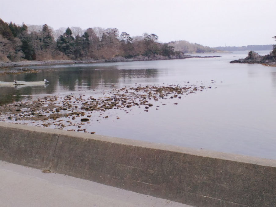
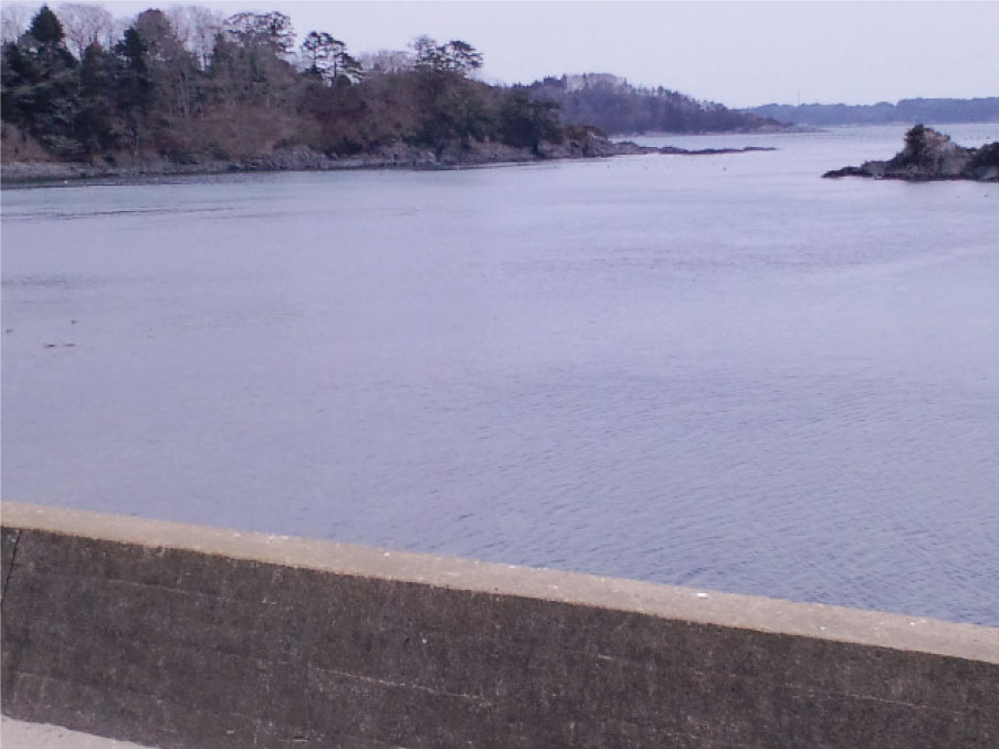
Small earthquakes that take place before a major earthquake are known as foreshocks. On March 9, 2011, an earthquake with a seismic intensity of 5– on the Japanese seisimic scale struck Miyagi Prefecture. The Japan Meteorological Agency issued a tsunami warning along the Pacific coast, for prefectures from Aomori to Fukushima. In Minamisanriku Town, Miyagi Prefecture, the tide level fluctuated for several hours, with the drawback revealing the rocks on the seabed. Mild tremors continued after the first shock.
A photograph of the drawback shot at Yoriki Utatsu, Minamisanriku Town, Miyagi Prefecture.
The seabed is clearly visible.
・ Date and time: 11:45 AM (local time), March 9, 2011
・ Scale of earthquake: Magnitude 7.3
・ Epicenter: Offshore Sanriku (N 38.20, E 143.17)
・ Tsunami height: 48 centimeters in Ayukawa, Ishinomaki City, Miyagi Prefecture
・ Dead: 0

