Izumisano City Disaster Prevention Map
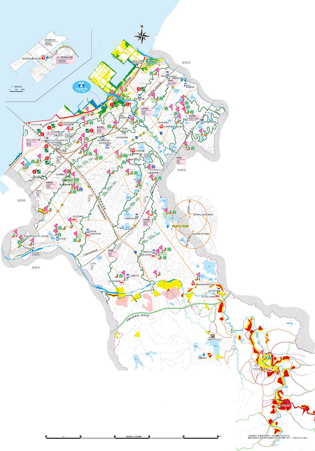
Disaster prevention facilities
Regional evacuation shelter
Temporary evacuation shelter
Evacuation shelter (building)
Welfare evacuation shelter
Hospitals and clinics
Fire station
Fire station branch
Firefighter volunteers' garage
Police station
Police box, police station branch
Disaster prevention wireless installation location (outdoor loudspeaker stations)
Heliport for disaster
Evacuation route
Park
Contour
Note: At the time of large-scale disaster, the general vehicle traffic is limited.
Landslide disaster
Steep slope collapse hazard sites
Landslide hazard site
Debris flow hazard mountain stream
Mountain disaster hazard district
Collapse earth and sand outflow hazard district
Mountainside collapse hazard district
Landslide disaster special warning area
Landslide disaster warning area
Flood prevention
Tide prevention line
Rainfall observatory
Water-level observatory
Flood-prevention pond
Rain water pump station
Underpass
| NO. | Temporary shelter during the tsunami (tsunami evacuation building) | Above sea level | Number of stories |
|---|---|---|---|
| 1 | Public University Corporation Osaka Prefectural University Rinku Campus | 4m | 5stories |
| 2 | Rinku Gate Tower Building | 5m | 56stories |
| 3 | Kansai International Airport Hotel Sun Plus Yutaka | 5m | 8stories |
| 4 | Sun City Hagurazaki | 5m | 10stories |
| 5 | City Hotel Airport Prince | 9m | 9stories |
| 6 | Municipal Matsubara complex housing | 4m | 5stories |
| 7 | Izumisano Luther Nursery School | 2m | 3stories |
| 8 | Surpass Izumisano | 4m | 9stories |
| 9 | Rinku Eruga Build. | 4m | 10stories |
(Note) Temporary shelter during the tsunami (tsunami evacuation building) is, in principle, the emergency, temporary shelter for those who have difficulty in moving to the hill evacuation shelter.