Osaka Museum of Housing and Living 8th floor
Modern Osaka Floor "See and feel Osaka"
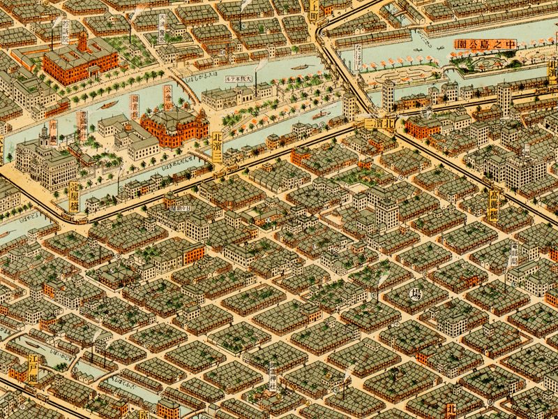
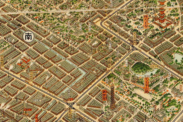
10. The panoramic map of the Great Osaka is a bird's eye view depicting Osaka city in 1923.
The view is from Osaka Bay towards the northeast.
Osaka Castle can be seen in the upper right hand corner, Osaka Station in the upper left hand corner, the harbor and a large pier in the lower left hand corner, New World on the right in the middle.
And Tennoji Park and Shitenno-ji Temple can be seen to the right of New World.
In the center of the map, districts that have existed since the Edo era, such as Senba, Shimanouchi, Tenma, are shown. We can see that they have a grid system.
Okawa (Yodogawa) river winds through the left half of the map, Canals like Yokobori, Nagahori and Dotonbori flow through Osaka city.
This abundance of rivers and canals has earned Osaka the title of the City of Water. If you look closely, public facilities, temples, tram stations, post offices, police boxes and bathhouses can be seen. This map allows you to imagine this town as if you were truly there.
The author of this map is Masajiro Minobe. The issuer is Ihei Kusaka (Osaka, Kusakawarajiya). It was issued in January 1924.
The following year on April 1st 1925, Osaka City merged with surrounding towns (the second city extension) and grew to 181 km2, increasing the population to 2.11 million people.
At that period, it became Japan's largest metropolis, even surpassing Tokyo City.
At that point Osaka City became number 6 on the list of most populated cities in the world.
This was the age of the so-called The Great Osaka.
Taking advantage of the economic ground existing since the Edo era, referred to as the kitchen of Japan, Osaka greeted the golden age of modern technology and flourished in industries such as trade, spinning, steel and modern architecture.
Osaka became a colorful and vibrant city.Iconic urban constructions of The Great Osaka, such as the Osaka Castle reconstruction(1931) , widening of Midosuji street(1937) and Osaka Municipal Subway Midosuji Line Construction (partially opened in 1933) are not represented in the map, because they were not yet completed at the time of the map’s period.The size of the original map is 78.5 cm by 108.6 cm.
