North-West direction
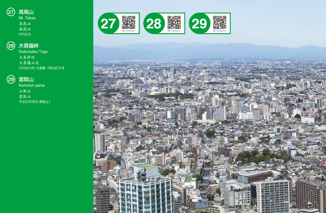
27 Mt. Takao
Introduction
Mt. Takao is a small mountain which has an altitude of 599m, located in Meiji no Mori Takao Quasi-National Park, Hachioji City, Tokyo. Since it is not very far from the down town area of Tokyo, it has many hikers and tourists; surprisingly, 2,600,000 hikers visit there annually, and it was approved by Guinness World Records. In addition, it achieved three stars in Michelin Green Guide Japan for three consecutive years. Visitors can enjoy a panorama view of the Kanto Plain on the observation platform located near to Takaosan Station on the mountain tram.
Access
Take an express or semi-special express train at Shinjuku Sta. on Keio line, and get off at Takaosanguchi Sta. after 50-min train ride. There is a mountain tram which is called “cable car,” and its Kiyotaki station is located within 5-min walking distance from Takaosanguchi Sta.
About the mountain
A tourist spot that has won three stars for three consecutive years in the travel guide "Michelin · Green Guide · Japon". Cable car From the observation deck near Takaoyama station, you can enjoy panorama overlooking the Kanto plain.
Hiking Trails
There are eight different trails for hikers to choose depending on hiking skill levels; for example, No.1 Trail is the easiest but longest trail that has a lot of places of interest, and it is also the approach to Head Temple Takao-san Yakuo-in; Inariyama Trail is the toughest trail goes along ridges and offers beautiful sceneries of mountains.
28 Daibosatsu Toge
Introduction
It is a pass located on the border between Koshu city and Kosuge village in Yamanashi prefecture. Its elevation is 1,897meters. It is well known for the novel which is named "Daibosatsu Toge" written by Kaizan Nakazato.
Route
Drive on Ome Kaido highway to Kami-Hikawa Toge where the path entrance is located, and go along the trail path.
About the mountain
Although once recognized as the difficult spot on the Ome-Kaido Avenue during Edo period, it has now become a very popular easy-hiking trail. In 1969, a radical communist party was there for military training in order to attack the prime minister’s official residence. 53 of them were caught by police. The incident is called Daibosatsu-Toge incident.
Approximate time
About a 40-minute walk from Kami-Hikawa Toge.
29 Kumotori-yama
Introduction
Mt. Kumotori is located in the center of Chichibu Tama Kai National Park and is a mountain of 2,017 m above the boundary of Tamba mountain village in Kita Tureu-gun, Yamanashi, Nagatachi-gun, Okutama-cho, Saitama Prefecture, Nishitama-gun, Tokyo. It is the highest peak in Tokyo and is the highest point. One of Japan's famous mountain mountains.
Route
From JR Shinjuku, take a 2-hour train ride on Chuo and Ōme lines to go to Okutama station. From Okutama station, a Nishi-Tokyo bus takes you to hiking entrances.
About the mountain
On the base camp of Mount Kumotori, there is a hot spring called "Sanjo-no-yu" that ease tired muscles of hikers.
Main hiking courses
Mitsumine course starts from Mitsumine shrine of Ootaki village in Saitama prefecture. Kamosawa course starts from Okutama city in Tokyo. Oodawa course starts from Nippara. Sanjo course starts from Sanjo-no-yu in Yamanashi prefecture.
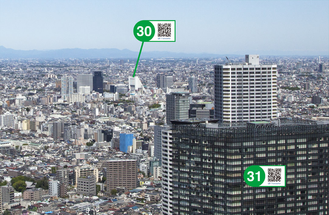
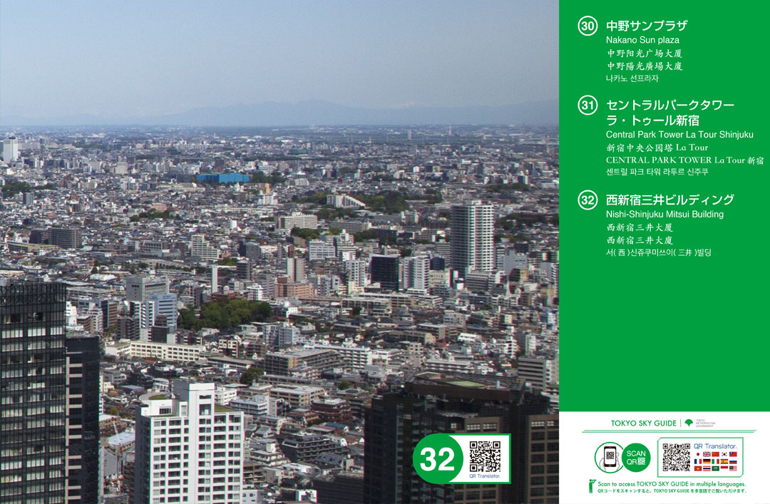
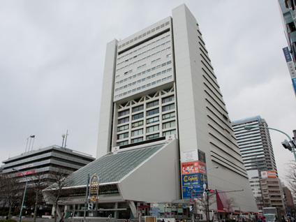
30 Nakano Sun plaza
Introduction
It has a distinctive design based on triangles. This was a cultural complex that included a hotel, wedding venue, and concert hall, but it closed in July 2023.
Route
From JR Shinjuku, take Chuo line and get off at Nakano station. It is right next to its north exit.
About the hall
Opened in 1973, its formal name was "Zenkoku Kinrou Sei-Shounen Kaikan." It became popular as a symbol of youth subculture. It has been run by a private company since 2004. A Japanese singer "Sun-plaza Nakano Kun" named himself after this hall.
Architects
Designed by Mr. Hiroyuki Inokura, it has received the Building Contractors Society Prize of Japan.
31 Central Park Tower La Tour Shinjuku
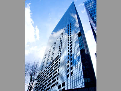
Introduction
La Tour Shinjuku is located to the north of the Shinjuku Central Park. When seen from above, it is a parallelogram shaped structure with huge glass surface. The high rise building complex consists of a 44-storied 167 meters high residential building and 17-storied 89 meters high office building.
Route
A six minute walk from Nishi-shinjuku Station (Exit 2) on the Tokyo Metro Marunouchi Line; A five minute walk from Tochomae Station (Exit 4) on the Toei Oedo Line.
About the Building
The complex gives the impression that a whole town is housed within rather than that of a collective housing area. Inside the complex, there are a kids' room, café, 24-hour-open supermarket, and a laundry exclusively for the tenants.
Architects
La Tour Shinjuku was designed by Nihon Sekkei, Inc., which is a pioneer in high-rise building design in Japan. Kajima Corporation and Taisei Corporation jointly constructed La Tour Shinjuku.
32 Nishi-Shinjuku Mitsui Building
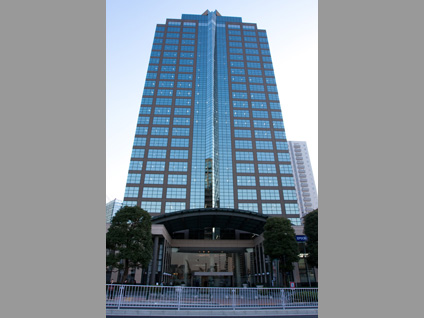
Introduction
This is a 111-meter high office building with 2-story basement and 27 stories above ground along Ōme Kaido highway. Its exterior is based on bluish-green glass panels.
Route
Choices are; 15-minute walk from Shinjuku station, 6-minute walk from Tochomae station on subway Oedo line, and 4-minute walk from Nishi-Shinjuku station on Metro Marunouchi line.
About the building
This is just an office building, no public observation deck inside. Many businesses are tenants in the building. Restaurants are on the lower floors. Events, such as concerts, are sometimes held in the vicinity. Do not confuse with Shinjuku Mitsui building.