South-West direction
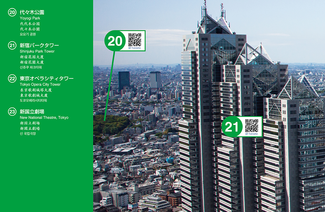
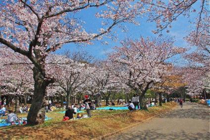
20 Yoyogi Park
Introduction
Connected to the south of Meiji Jingu, the park forms vast greenery. It is also known for having enhanced water facilities including fountains which make its characteristic water sceneries.
Route
After a 4-minute train ride from JR Shinjuku on Yamanote line, get off at Harajuku station, and it is a 3-minute walk. It is also a 3-minute walk from Meiji-Jingu-mae station on Metro Chiyoda line.
The park’s history
After World War II, the former Army parade ground was requisitioned by the General Headquarters of the Occupation Force. After the restoration, Tokyo Olympic Games used the place as an athletes’ village. Then it was maintained and turned into a public park. It has a unique structure; Inokashira-dori street divides the park into A and B districts, and there is a pedestrian bridge between the districts.
21 Shinjuku Park Tower
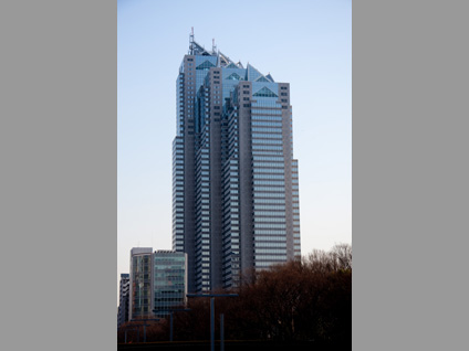
Introduction
This sky scraper features a very distinctive look as if three titled buildings were bound together. With 5-story basement and 52 stories above ground, it is 235 meters high.
Route
It is a 12-minute walk from the south exit of JR Shinjuku station.
About the building
Living Design Center "OZONE" occupies from 3rd to 7th floors, and it holds various events throughout the year. The Park Hyatt Tokyo Hotel occupies the floors from 39th and above.
Architects
The distinctive design is done by Kenzo Tange as well as Tokyo Metropolitan Government Building.
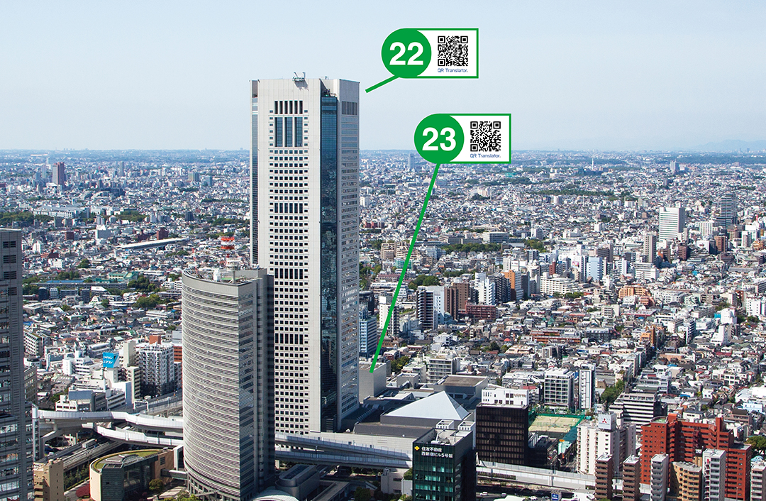
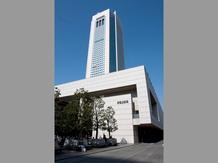
22 Tokyo Opera City Tower
Introduction
Tokyo Opera City Tower is a commercial complex contains offices, stores, and a theater. It is 234-meter high with 4-story basement and 54 stories above ground, standing right next to the New National Theater.
Route
Get off at Hatsudai station which is 1 minute train ride from Shinjuku station on Keio Shinsen line. The tower is directly connected to the underground exit of the station. If drive, it takes 5 minutes from the Tokyo Metropolitan Government Building.
About the tower
Since Toru Takemitsu, a Japanese composer, was an advisor, its formal name is "Tokyo Opera City Concert Hall: Takemitsu Memorial." It gives some event including a free concert in every lunch time and the communication arts exhibited by NTT ICC art gallery. These events enable people to enjoy arts readily.
Architects
As well as the New National Theater, it was built by Takahiko Yanagisawa.
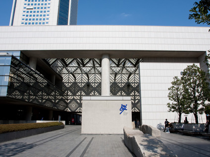
23 New National Theatre, Tokyo
Introduction
The theatre is for modern theatrical performances including opera, ballet, modern dance, and drama. It consists of three theatres; such as, opera, medium and small theaters.
Route
Get off at Hatsudai station after 1-minute train ride on Keio line from Shinjuku. Its central exit is connected to the theatre. If drive, it takes 5 minutes from the Tokyo Metropolitan Government Building
About the Theatre
Season tickets to allow you to enjoy popular performances at the New National Theatre, Tokyo are now available for purchase. You can see top shows either all season or in combination with your favorites.
Architects
Takahiko Yanagisawa was chosen as a designer after the International Design Competition.
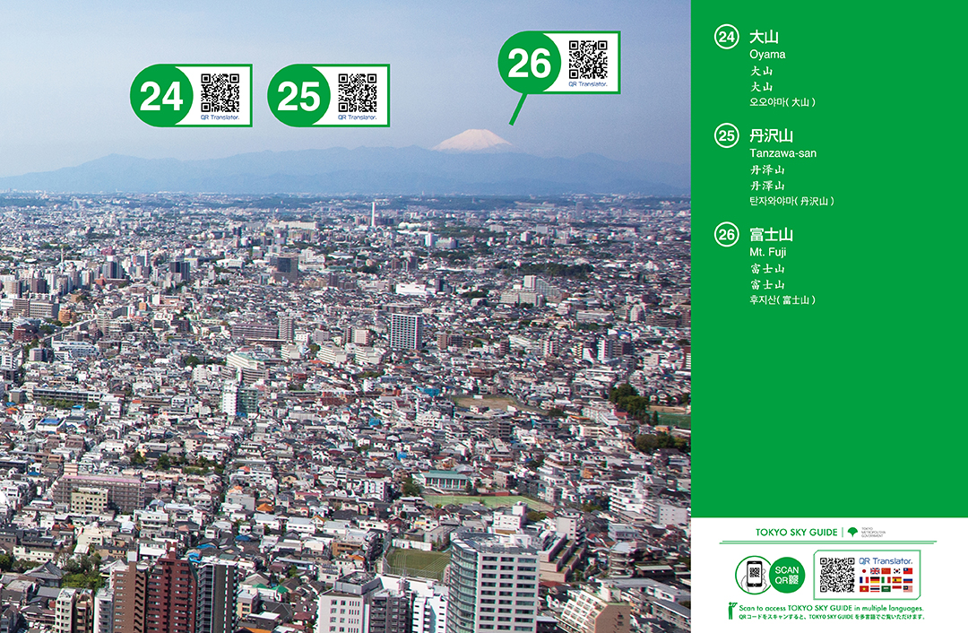
24 Oyama
Introduction
Mount Oyama is 1,252 meters high. It is located in the east end of Tanzawa-Oyama National Park in Isehara city of Kanagawa prefecture.
Route
Take the express train bound for Odawara from Shinjuku on Odakyu line. It takes an hour to take you to Isehara station. At the north exit of the station, take No.4 bus bound for "Oyama-Cable" and get off at the terminal bus stop.
About the mountain
It has a beautiful pyramidal peak. 2-hour access from Tokyo is convenient for hikers. It is one of "the best 50 sightseeing spots in Kanagawa." The view from the top is great.
Average hiking time
About 2 hours to the top.
25 Tanzawa-san
Introduction
Tanzawa-san, or Mt. Tanzawa, belongs to Tanzawa-Oyama National Park and is located in the Tanzawa mountain range which is in the western part of Kanagawa Prefecture. Its elevation is 1,567meters. The mountain and a lodge, called Miyama Sansou, on its top attract nature lovers from the greater Tokyo area through all seasons. (One of Japan’s best 100 mountains.)
Route
Hiking can be started from the following stations; Hon-Atsugi, Hadano, Shibusawa, Shin-Matsuda, and JR Matsuda station on Gotemba-line; all of which are about 1 hour train ride on Odakyu line from Shinjuku station.
About the mountain
Initially, "Tanzawa-san" was a generic name for the successive mountains in the center of Tanzawa mountain range. In Meiji period, surveyors put a triangular point named Tanzawa-san on a mountain. Then, the name remained as the mountain’s name. It has been said that Kyuuya Fukada chose the collective mountains as one of the Japan’s best 100 mountains, not only Tanzawa-san itself.
26 Mt. Fuji
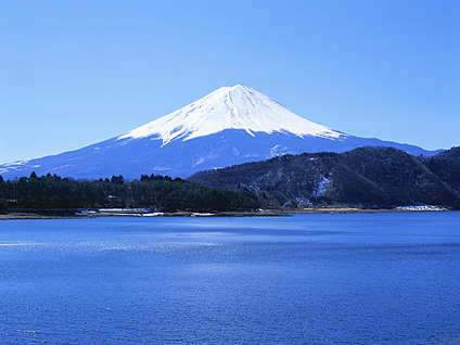
Introduction
Mt. Fuji is a cone volcano that sits on the border between Shizuoka and Yamanashi prefectures. It is the highest and the most famous Japanese mountain. Its summit is 3,776 meters above sea level.
Route
There are many trail entrances for mountain hiking; such as, Kawaguchi-ko, Fujinomiya, Subashiri, Gotemba, and others. Please refer to a detailed guidebook.
About the mountain
Mt. Fuji has been attracting Japanese people since ancient times; sung in poems written in circa 8th century. Even now it is an active volcano, gathering people’s attention.
Average hiking time
It will be 2-day hiking; half a day to the top, and quarter of a day to go down.